Antarctica InSync
Antarctica InSync is a global effort to synchronise research across Antarctica and the Southern Ocean, connecting ice, ocean, climate, and life to protect this vital region. Website
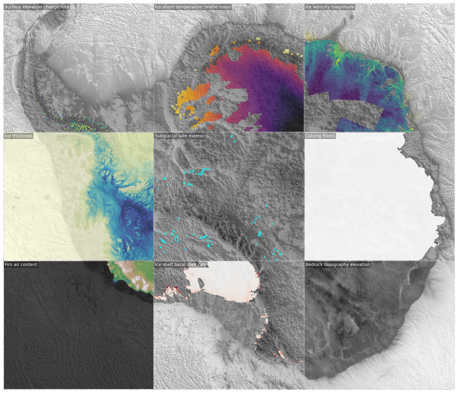
As part of the initiative, and to facilitate easier analysis of and access to scientific Antarctica data, the the below datasets are combined into zarr stores, reprojected to a common 100x100m grid in the EPSG:3031 Polar projection.
The Data
The datasets we have processed are:
-
Ice shelf Basal Melt
- Original Data Source: Data and code for: "Annual mass budget of Antarctic ice shelves from 1997 to 2021"
- Reference: https://www.science.org/doi/10.1126/sciadv.adi0186
-
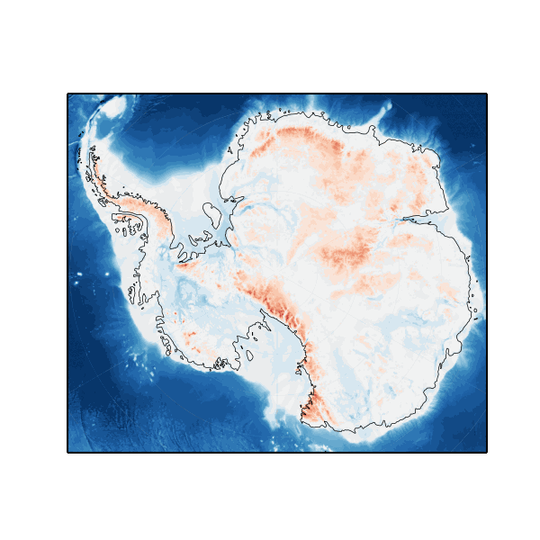
Bed topography/bathymetry map of Antarctica
- Original Data Source: ESA Open Science Catalog | ESA Open Science Catalog
- Reference: MEaSUREs BedMachine Antarctica, Version 3 | National Snow and Ice Data Center
-
Calving Fronts
- Original Data Source: https://zenodo.org/records/5903643
- Reference: Antarctic calving loss rivals ice-shelf thinning | Nature
-
Groundlines
- Original Data Source: Files
- Reference: https://nsidc.org/sites/default/files/nsidc-0498-v002-userguide_1.pdf
-
Ice Temperature Profiles
- Original Data Source: Data and code for: "Annual mass budget of Antarctic ice shelves from 1997 to 2021"
- Reference: https://www.science.org/doi/10.1126/sciadv.adi0186
-
Ice velocity
- Original Data Source: ESA Open Science Catalog | ESA Open Science Catalog
- Reference: Ice Sheets (Antarctic)
-
Surface Elevation Change
- Original Data Source: ESA Open Science Catalog | ESA Open Science Catalog
- Reference: Ice Sheets (Antarctic)
-
Subglacial Lakes
-
Supraglacial Lakes
- Original Data Source: https://zenodo.org/record/5642755
- Reference: ESSD - An inventory of supraglacial lakes and channels across the West Antarctic Ice Sheet
Visualization
You can see a visualisation of the data in eodash:
Access
These datasets are grouped based on their dimensions into several cubes:
- https://s3.waw4-1.cloudferro.com/EarthCODE/OSCAssets/antarctica_cube/antarctica-combined.zarr
- Bedrock topography
- Ice shelf Basal Melt
- Groundlines
- Subglacial Lakes
- Supraglacial Lakes
- https://s3.waw4-1.cloudferro.com/EarthCODE/OSCAssets/antarctica_cube/icetemp.zarr
- Ice Temperature Profiles
- https://s3.waw4-1.cloudferro.com/EarthCODE/OSCAssets/antarctica_cube/sec.zarr
- Surface Elevation Change
- https://s3.waw4-1.cloudferro.com/EarthCODE/OSCAssets/antarctica_cube/icemask_composite.zarr/
- Calving Fronts
- https://s3.waw4-1.cloudferro.com/EarthCODE/OSCAssets/antarctica_cube/ice_velocity.zarr
- Ice Velocity 2020-2021
You can read the data from an individual cube using any zarr reader, e.g Python:
import xarray as xr
ds = xr.open_zarr(url)
ds
or combine the cubes with:
import xarray as xr

cube_paths = [
    "https://s3.waw4-1.cloudferro.com/EarthCODE/OSCAssets/antarctica_cube/icetemp.zarr",
    "https://s3.waw4-1.cloudferro.com/EarthCODE/OSCAssets/antarctica_cube/sec.zarr",
    "https://s3.waw4-1.cloudferro.com/EarthCODE/OSCAssets/antarctica_cube/antarctica-combined.zarr",
    "https://s3.waw4-1.cloudferro.com/EarthCODE/OSCAssets/antarctica_cube/icemask_composite.zarr/",
    "https://s3.waw4-1.cloudferro.com/EarthCODE/OSCAssets/antarctica_cube/ice_velocity.zarr"
]

ds = xr.open_mfdataset(cube_paths, engine="zarr",chunks={},compat='no_conflicts')
ds